It’s Grim up North
A moderately successful trip to Arctic Norway
by Dave Beynon
The Fort William of the North
“You have taken me to Fort William!” accused J.P. I checked the map. We were about 5km from Tromsø, several hundred km north of the Arctic circle and heading roughly south on the E8. Pointing this out did not help. “This is Fort William, in February, in a thaw!” he insisted. I was pretty sure it was mid June. He gestured at the road “Dual carriageway. A82!”, out to sea “Loch Linnhe!”, up the hill “Cloud base 250m, rotten snow from 200m, 5 degrees, raining! This is Fort William on one of your winter trips in February!”. I had to concede that he had a point.
Time for plan B. We were going to Lofoten.
Introduction
I had convinced my friend John Proctor that Norway would be a pleasant change from his usual central Asian climbing destinations. Early spring is probably the best time for alpine climbing, with late summer being ideal for rock.
Unfortunately work commitments had forced us into a narrow time window in June that wasn’t quite ideal for either activity but could offer both, so we needed to be flexible. If it was cold we could go and play in the snow, if it was warm then we would stick to rock climbing.
Plan A
We did not go here.
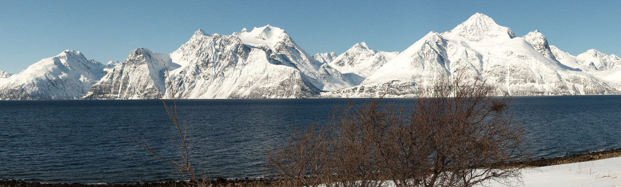
The original plan was to fly to Tromsø and attempt some alpine routes in the Lyngen Alps, followed by some mountain and rock climbing on the island of Kvaløya. If we had time we might pop down towards Narvik and have a look at the famously pointy Stetind and some of its neighbours.
The Lyngen peninsular is about an hours drive east of Tromsø, with a range of small but heavily glaciated mountains. I had been there before in winter but deep snow had limited our options to snow shoeing and walking so I was keen for a rematch.
Kvaløya is a large mountainous island just to the west of Tromsø. It has a wide variety of climbing, from seaside boulders to large granite walls and alpine ridges. I had recently got my mitts on the guidebook, and this was to be the second target.
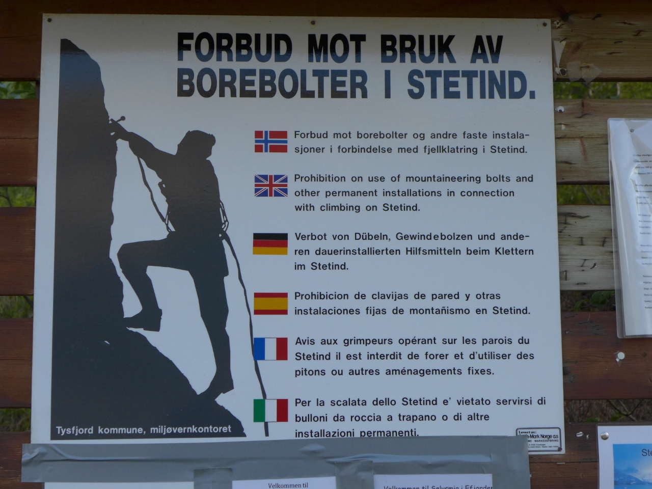
Finally, the area around Narvik contains a number of impressive granite mountains. The most famous of these is Stetind, which was once voted the national mountain of Norway. It is an improbable looking fin of granite that sticks straight out of the sea to an altitude of just under 1400m.
The Lofoten islands had been pencilled in as a possibility, but we didn’t really plan to go there. They were over 5 hours drive away from our main objectives and as the driver I had decided that I really couldn’t be bothered.
Plan B
About a fortnight before departure the web cams in Lyngen and Kvaløya showed nothing but clear skies and sun. A week before departure the clouds arrived and by the time we landed in Tromsø it was positively Scottish. Fortunately it looked a bit better further south, so we decided to go to Lofoten after all.
Arrival

Packing it in
The journey to Tromsø was somewhat stressful. Our flight from Gatwick to Oslo had been slightly delayed, which left us only about 30 minutes to collect our luggage, check it in, pass back through security and get to our flight. The gate was at the far end of the airport of course, so we had to run.
After landing at Tromsø I continued my unbroken streak of not getting the hire car I ordered, and spent some time trying to work out how to get all the bags into a VW Fox. Eventually we managed to get everything in and it was time to go.
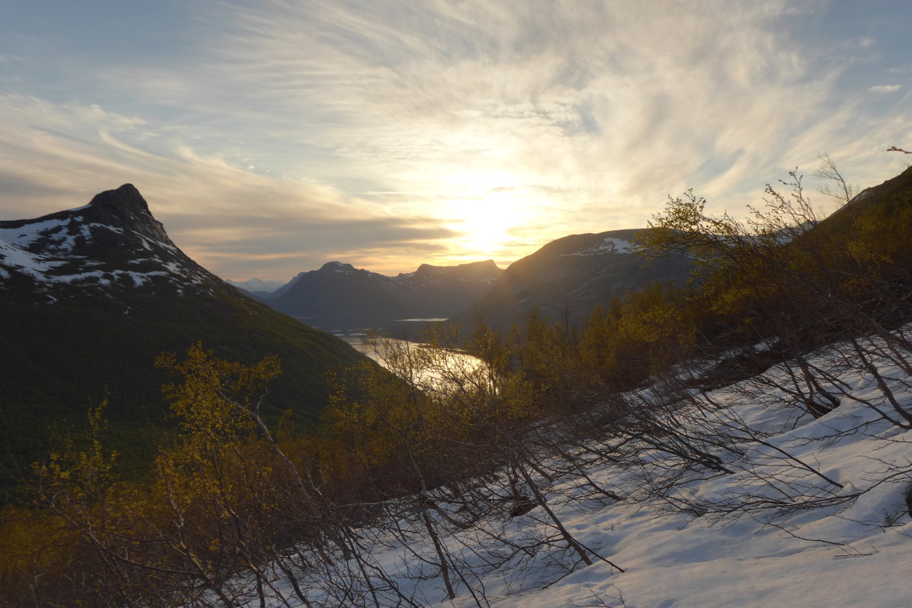
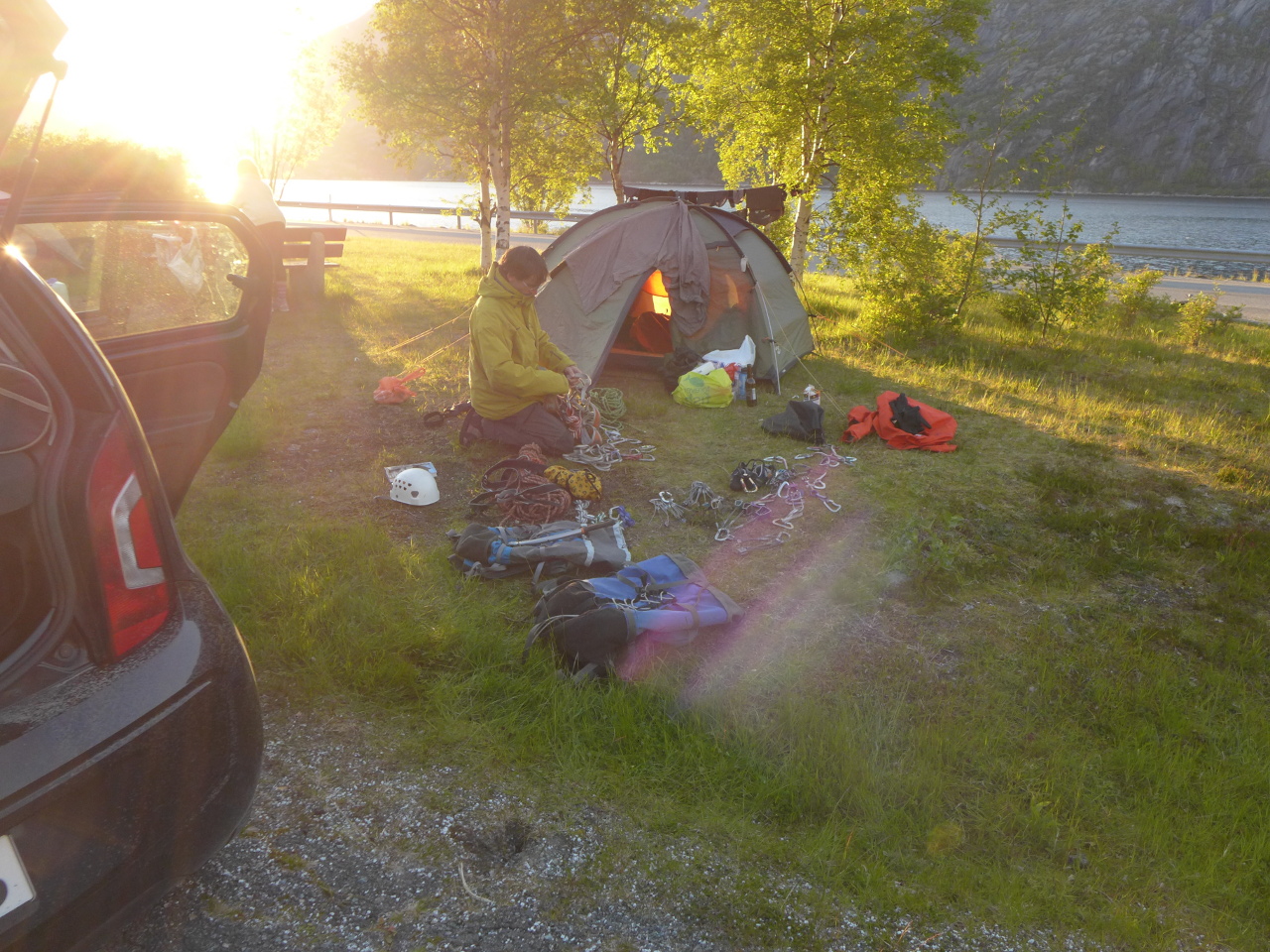
After a brief stop for groceries and pizza it was time to bite the bullet and start driving. We arrived at the camp site in Kabelvåg, just to the south of Svolvaer in broad daylight at around 1am. It was overcast but the cloud was high and we had an excellent view of the eastern flank of Vågkallen.
Lofoten
Feeling damp on Pianokrakken
The weather wasn’t brilliant so it seemed reasonable to start with something quick and easy. A quick ascent of “Pianohandler Lunds rute” on Pianokrakken would be just the thing to get us started.
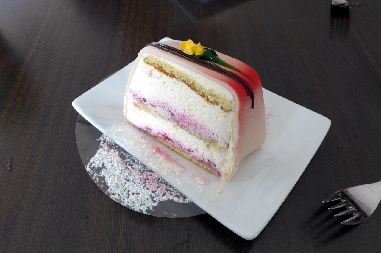
The rain began at about the same time as we arrived at the foot of the crag but wasn’t really heavy enough to cause much trouble. The route is a mix of slab, corner and juggy face climbing on excellent granite. It is graded n4+, which is roughly equivalent to severe. We were both quite damp by the time we reached the car so a detour for coffee and cake at the Climbers Cafe in Henningsvaer seemed like a sensible way to end the day.
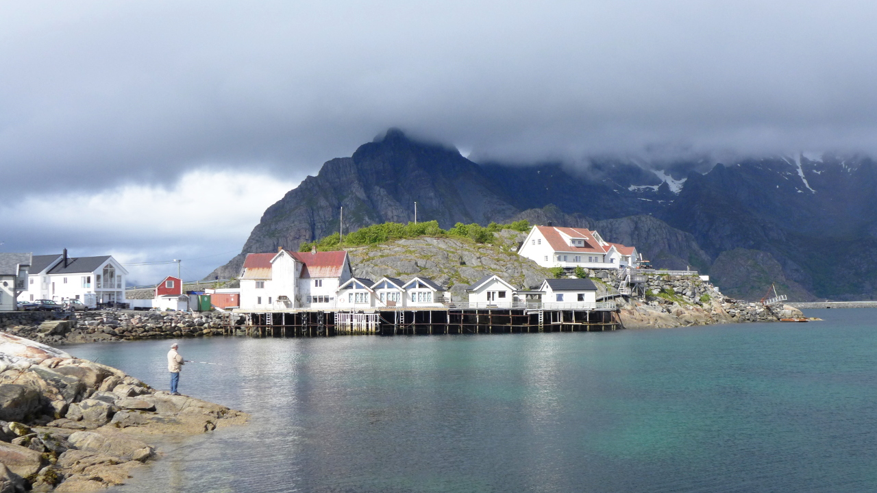
Henningsvaer between showers.
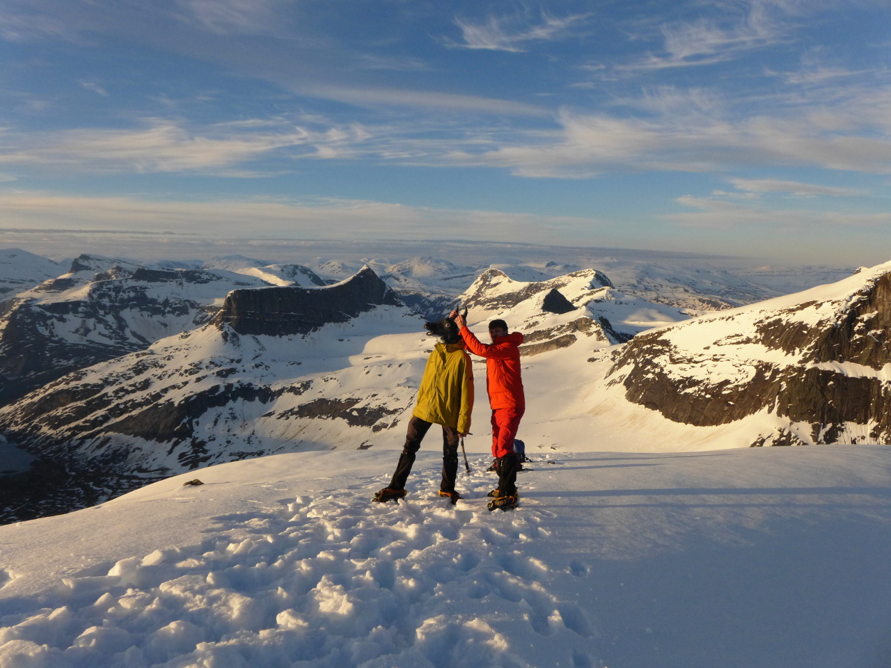
Getting my Goat
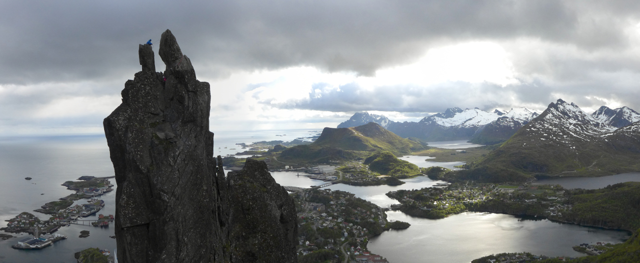
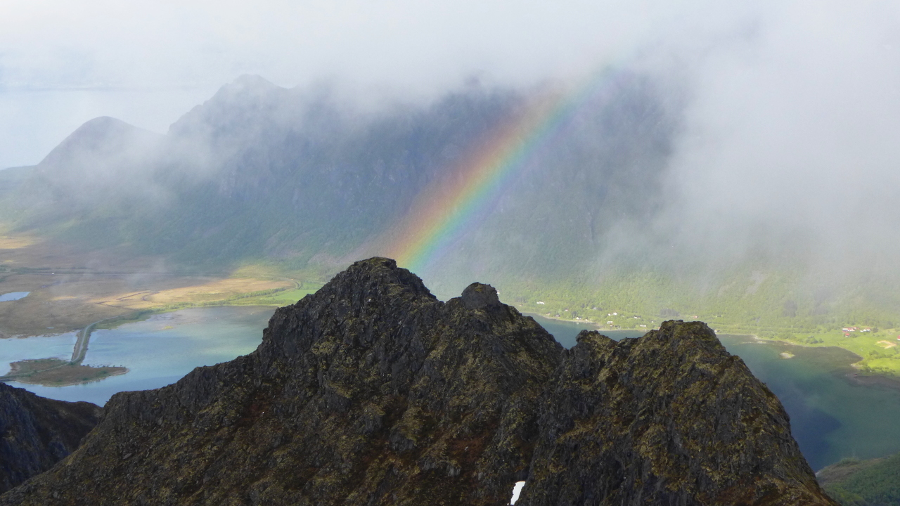
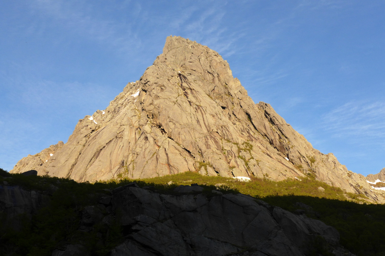
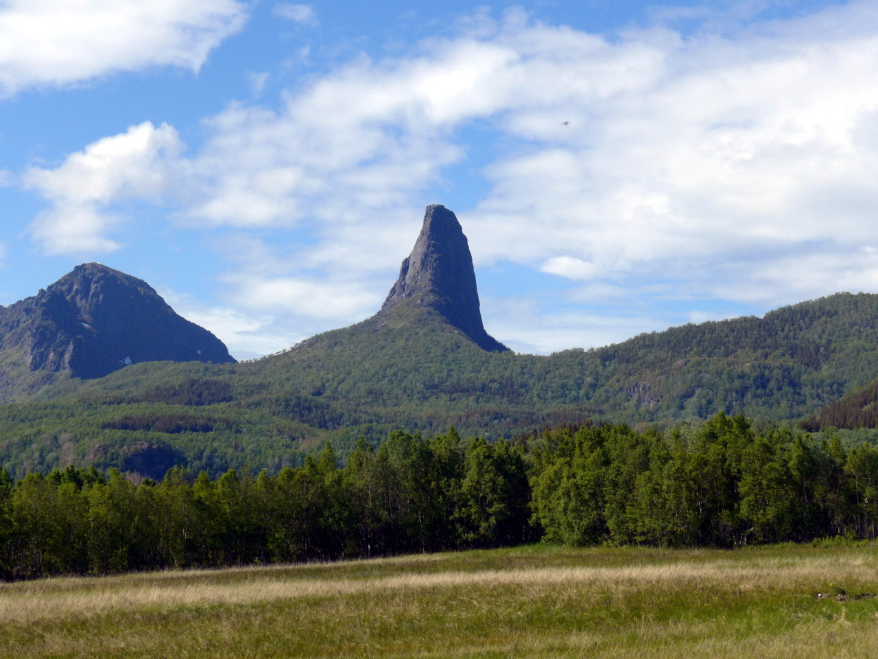
The next day appeared to be a washout so we went for a short walk around some lakes, then spent some time pottering around in Svolvaer. Fortunately the rain started to clear late in the afternoon and persuaded us to go and have a look at Svolvaergeiter, the Svolvaer goat.
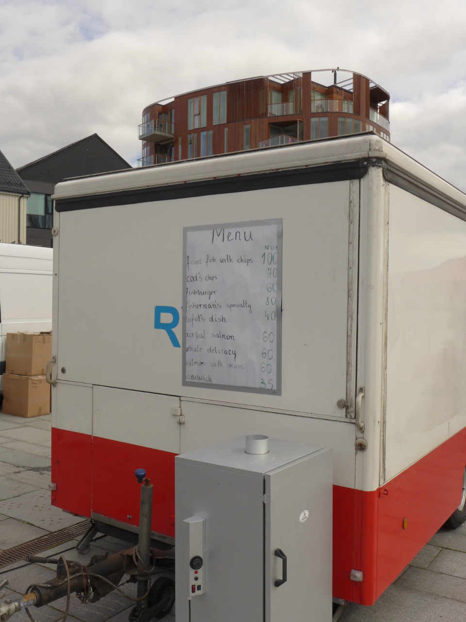
Which bit is the “delicacy”?
After embarrassingly failing to get off the ground on the direct start of “rappelruta” we decided to go for the classic “1910 ruta” (n4+). I remembered leading all 3 pitches a decade ago but couldn’t really remember the details. It was Johns lead anyway so I let him skim read the book and have the first pitch.
We did not climb the first pitch of the 1910 route, despite Johns insistence that the slightly loose and Very Slippery groove he climbed was “consistent with the guidebook description”. He reached a belay just as it started raining. The difference between bridging on dry and wet lichen is stark and the second found it a bit stressful. A Disagreement ensued.
A couple of days later we tracked down one of the guidebook authors to find out what we had actually climbed. Surprisingly he revealed that the line was unclimbed, or at least unclaimed. I suspect that loads of people have done it but were all too embarrassed to own up.
Rain & Snow
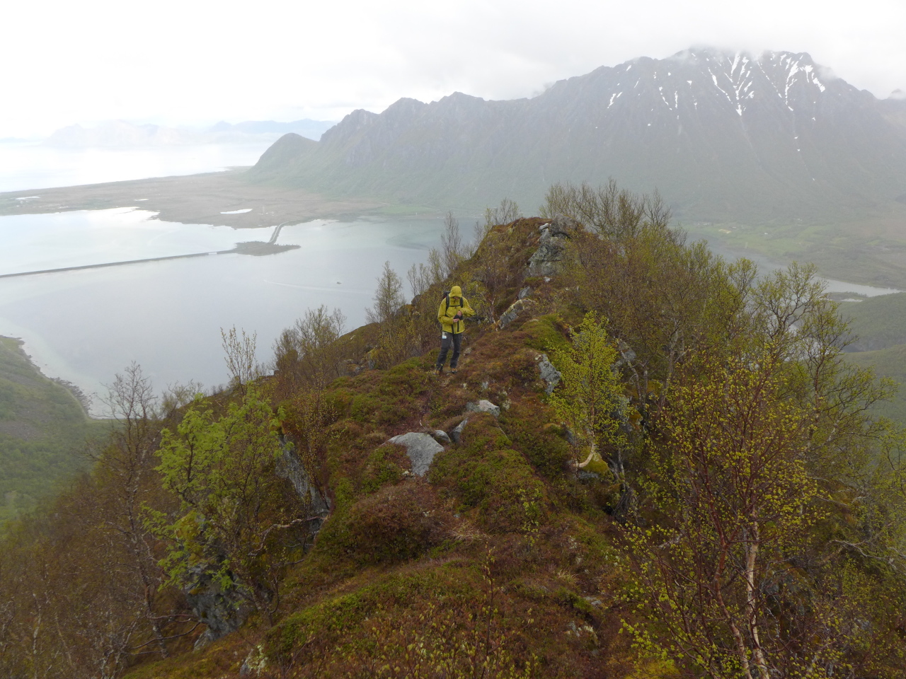
For the next couple of days the weather seemed best suited to walking, with heavy rain showers blowing in every few hours. A small hill called Matmora seemed to be a sensible objective. The map showed a ridge to the north which looked likely to have some scrambling, and a way marked track ran along the main ridge to the north west for descent.
The day was ultimately unsuccessful but good fun. A stroll along a farm track took us to the bottom of the forested hillside. Bushwhacking interspersed with wet, mossy scrambling moves on crumbling rock accounted for the first 500 meters of ascent before we emerged onto a narrow grass ridge leading to a subsidiary peak at 577m.
The way ahead seemed feasible. There was a snow filled bowl dead ahead that looked a bit dodgy, but to the right of this a steep strip of grass led to a narrow ridge which would almost take us to the summit. We would have to pass a cornice but that’s what axes were for.
On closer inspection the ridge seemed to be composed of moss and loose boulders. On the other hand the snow on the left came straight from the textbook chapter about “wet snow avalanches”. Moss and choss! Fanastic!
 The ridge turned out to be disappointingly solid, with only 2 or 3 mandatory heather holds. Unfortunately the top section disappeared into the snow about 10m below the cornice, and offered the tempting combination of slush on slabby rock and a bad landing. Having left the ropes behind we reluctantly did the sensible thing and turned around.
Sun & Slabs
Pillaren
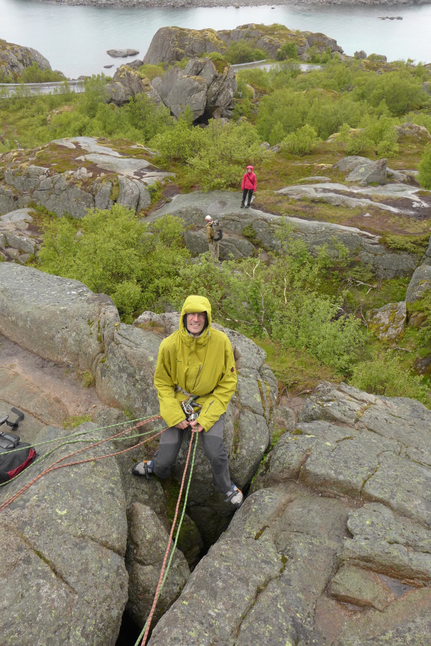
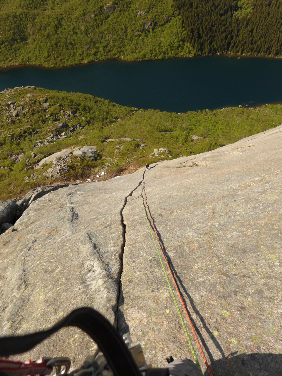
One of the most famous routes in Lofoten is Bare Blåbaer on Pillaren in Dupfjord (n5-). The weather was set to improve and being mid week it wouldn’t be too busy. We agreed that this would be a good choice for the next morning.
We set off fairly early and saw nobody on the walk in. This seemed to be a good sign until we realised that everyone else had set off earlier and was either on the route already or queuing at the bottom.
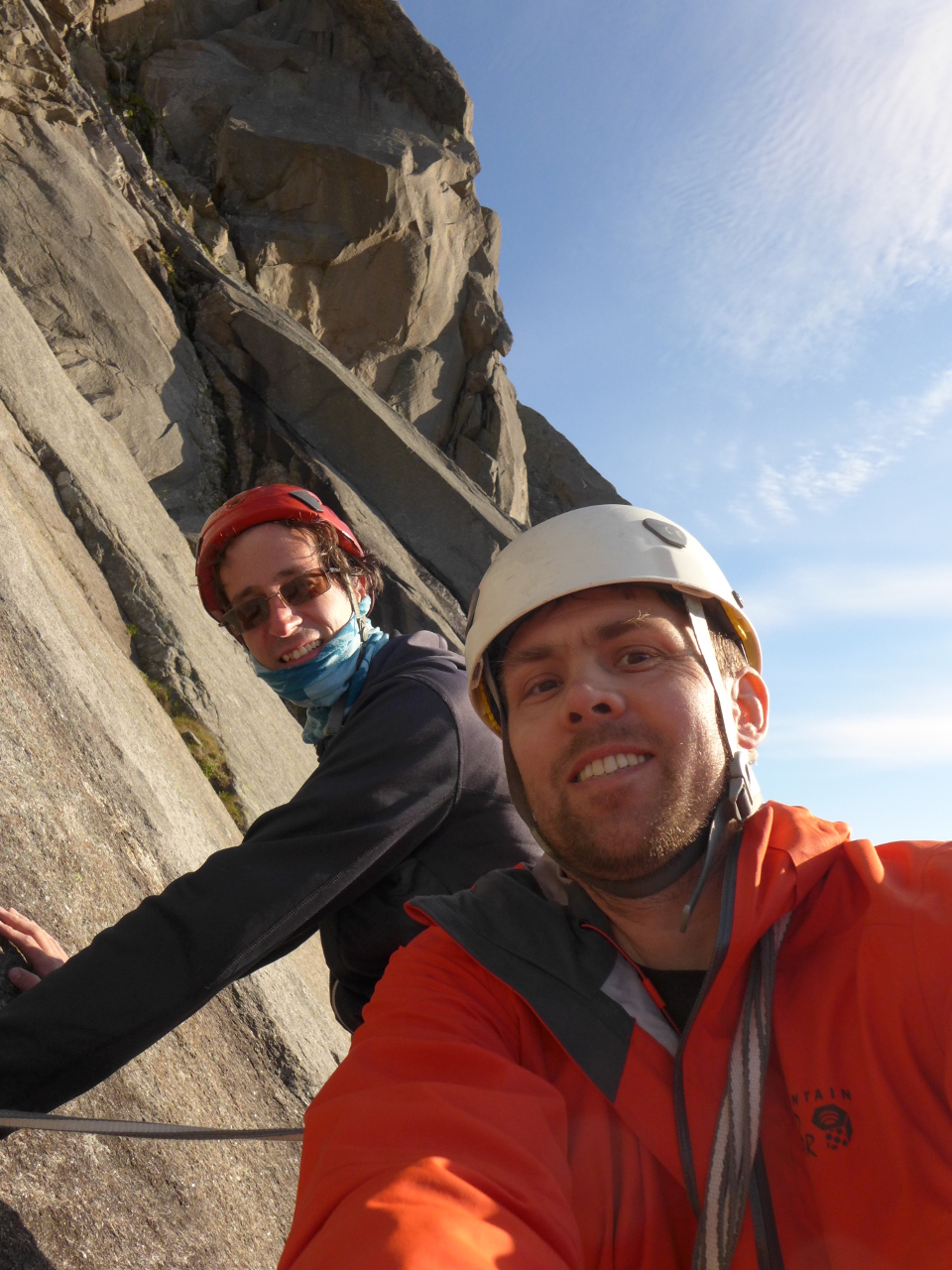
The climb was well worth the wait with 7 long pitches of slabby jamming cracks and laybacks on rough granite, mostly around HS. The first two pitches were in the shade and freezing cold but after that we emerged into bright sunshine. By the end of the day we were cooking in our jackets and cursing ourselves for leaving the water at the bottom.
Perfect finger jamming.
The whole route was excellent but for me the highlight was the 5th pitch. This consists of about 50m of finger jamming on a steep slab. In theory the whole pitch can be protected perfectly but every placement is almost exactly the same size so gear has to be rationed. You could build a rack for it I suppose but that would spoil the fun.
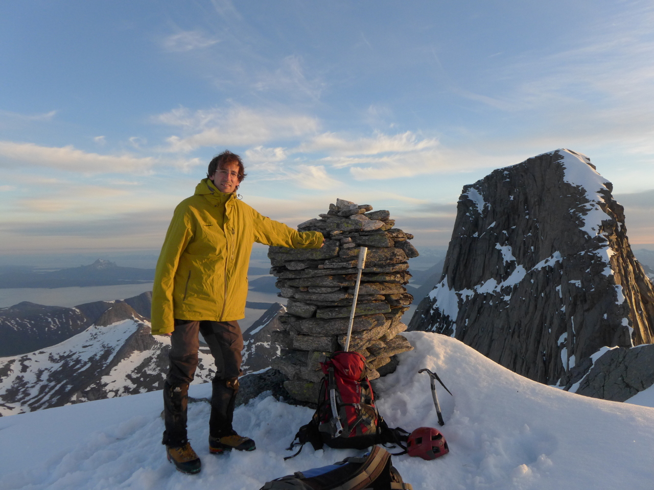
 Stetind
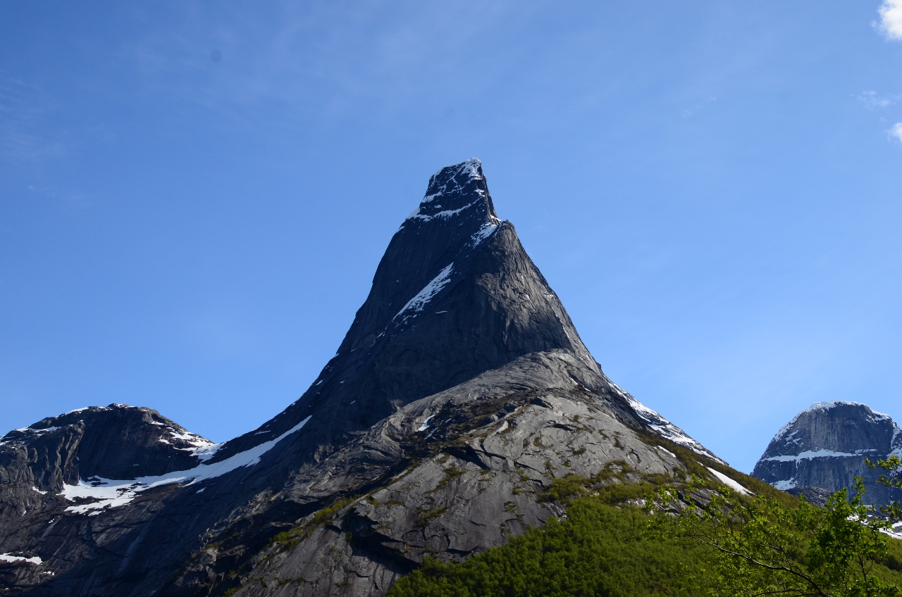
Stetind
Emboldened by the weather and recent success we decided to drive around to the Narvik area and take a look at Stetind. The standard summer route consists of a walk from sea level to a false summit named Halls Fortopp at 1314m, this is followed by a rocky ridge scramble with a pitch of climbing to the main summit at 1390m.

The best situated toilet in Norway?
As we arrived at the car park we could see a considerable amount of snow on the north face. The route we intended to take was to the south, and as all the southern faces in Lofoten had been clear we decided it was still worth a look.
Who packed the Hilti?
As we put our tent up and started cooking we got talking to a group of Finnish climbers. They turned out to be friends of a pair we had kept running into in Lofoten, and had brought a welcome supply of alcohol across the border. They were planning to attempt the classic “Sydpillaren” the next morning. This is a 13 pitch n6-, which is about E1 in British money.
And who packed all this crap?
Take 1
They left the camp site around 5am. Our route was easier so we allowed ourselves another hour in bed. After an hour walking we met the Finns coming back down. It turned out that the approach to their route involved crossing slabs that were still wet with snow melt. The higher sections looked dry but were unreachable.
 The path to the south ridge led through a snow filled bowl which was in the sun. It looked possible to save time and avoid the worst of it by heading directly up to the ridge via a steeper slope that was still mostly shaded. This worked well at first but the sun soon came around and after an hour it was obviously time to turn back.

Turning around.
Take 2
Real

Fake!
We began the second attempt some time after 10pm the next day. Just before the first large snow field we met a father and son heading back down. They reported that the final summit ridge was still very icy and that they decided not to attempt it, but that it looked possible. We had quite a long chat and a bite to eat before resuming the ascent.

No snow on the ridges at least!
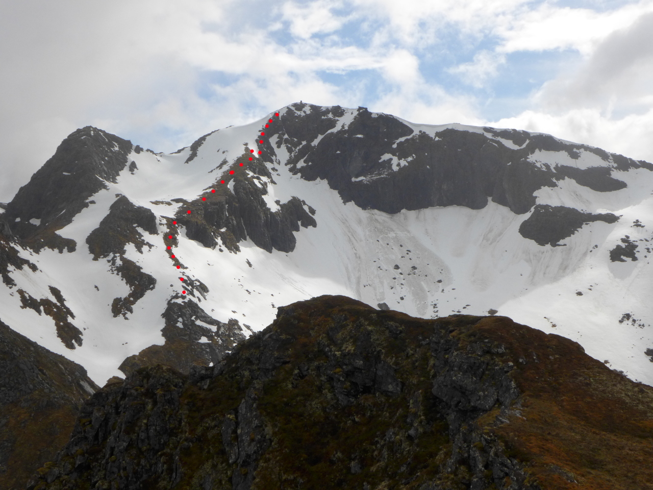
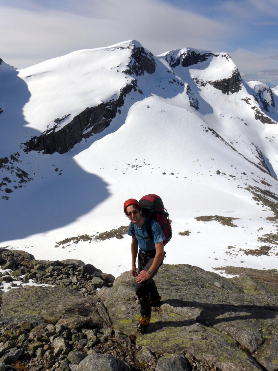
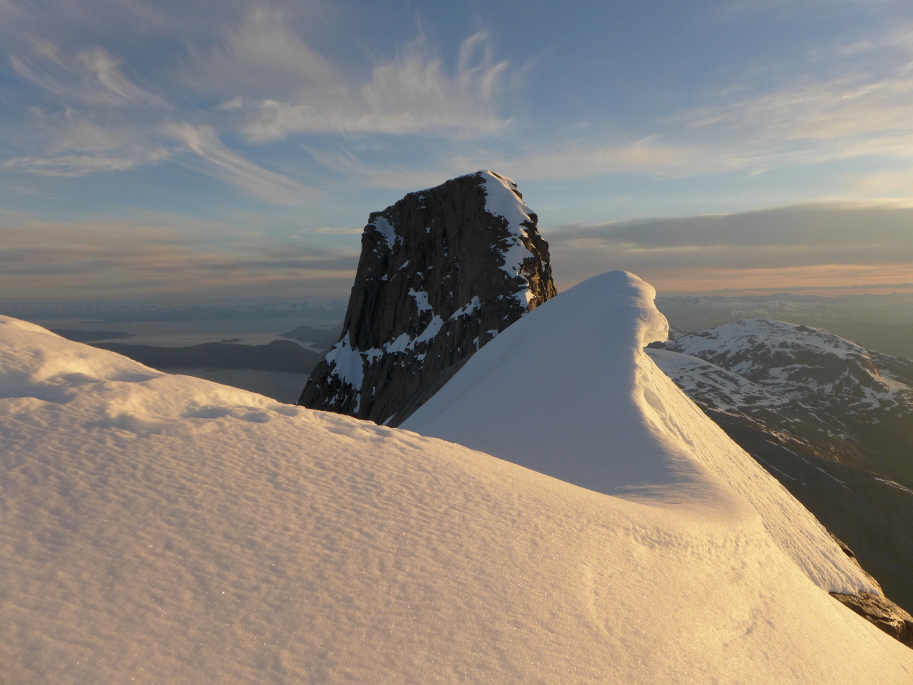
I found the snow slope to the main ridge very hard going. J.P seemed to run up it and appeared to enjoy disappearing into the distance as I plodded along through knee deep snow. The fiend! Eventually we both reached Halls Fortopp and the way ahead became clear.
3am at Halls Fortopp, with Stetind in the background.
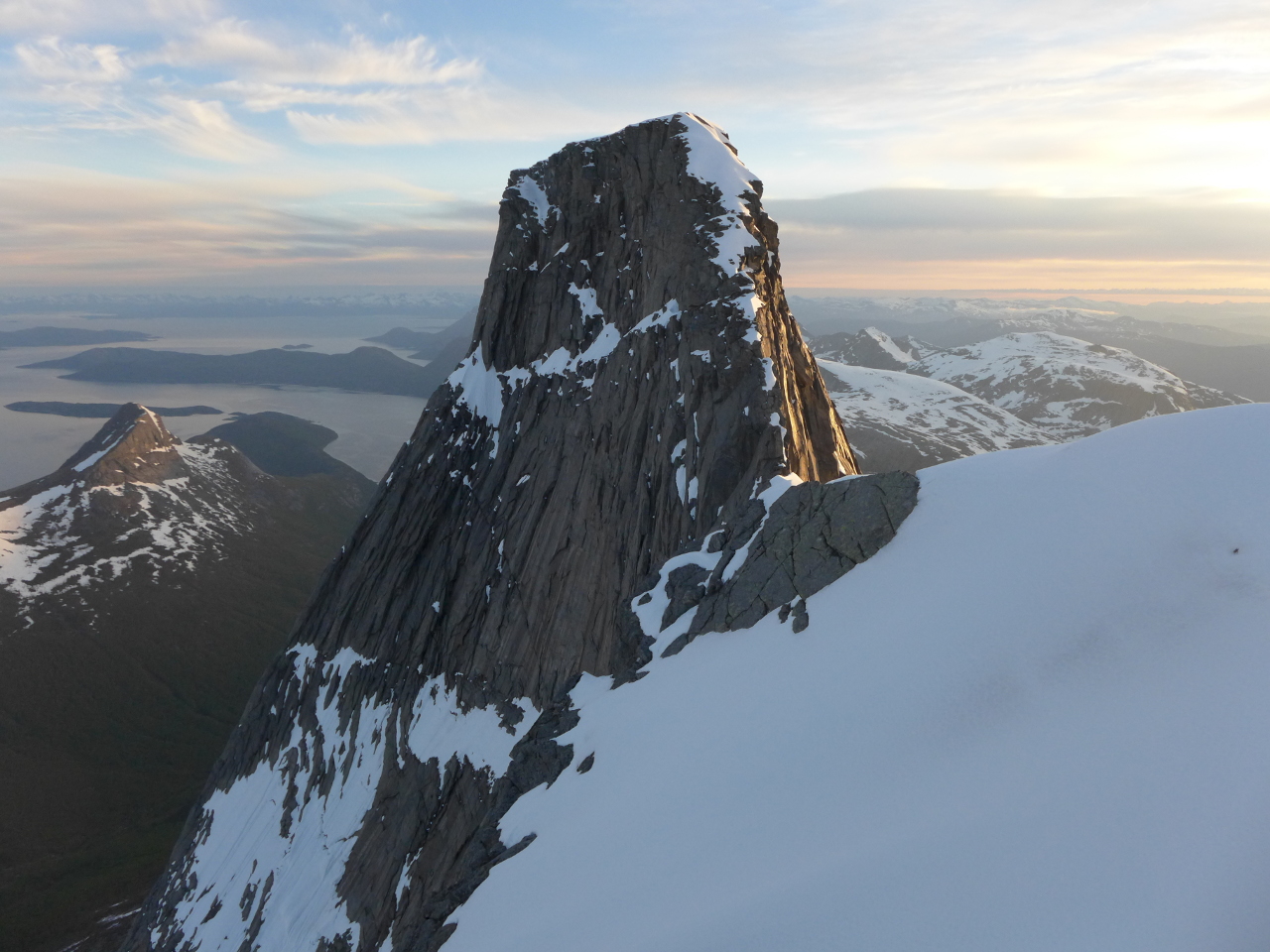
Stetind from Halls Fortopp.
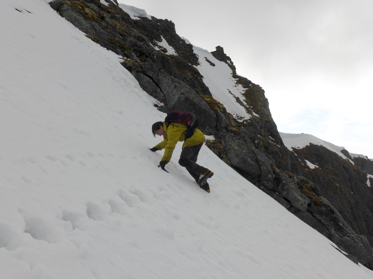
The first part of the ridge consisted of a snow arête with a cornice on the right. The left hand side was in the shade and seemed solid but the cornice was dripping noticeably in the 3am sun.
 We took a few pictures then roped up with John in the lead. The traverse wasn’t particularly difficult so I was a little surprised when he announced that we were turning back.
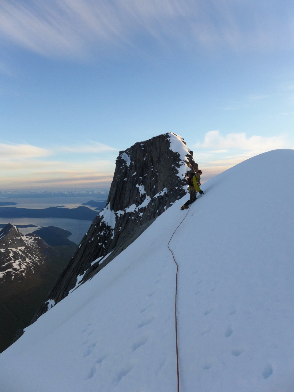
The next section consisted of a down climb followed by a level section on a knife edge arete. In summer this is often taken a cheval due to a lack of any kind of holds. Unfortunately the snow prevented us from doing this. There were no obvious belays, and walking along the top of the cornice in direct sunlight appeared to be the only way to pass. It wasn’t worth it.
What depravity is this? Kugelhornet in background.
Disappointed and somewhat chastened we trudged back to the valley, drove back to the camp site in a tired grey fog and slept through what was certainly the nicest day of the trip.
Skutvik
Hamarøyskaftet
Snow conditions on the nearby hills didn’t look any different to those on Stetind and the weather forecast was lousy. The outlook for Lofoten was slightly better and there was a regular car ferry from Skutvik to Svolvaer so we decided to aim for that next morning.
As we drove toward Skutvik there wasn’t a cloud in the sky. One of us remembered that there was climbing on a hill called Hamarøyskaftet, which was almost on the way. The book confirmed that it wasn’t particularly high and there was a route at n5-, the same as Bare Blabaer. Promising!
From the road Hamarøyskaftet appears as an absurd spike. It’s not quite as visually impressive as Stetind, but isn’t bad. Crucially it was clear of snow.
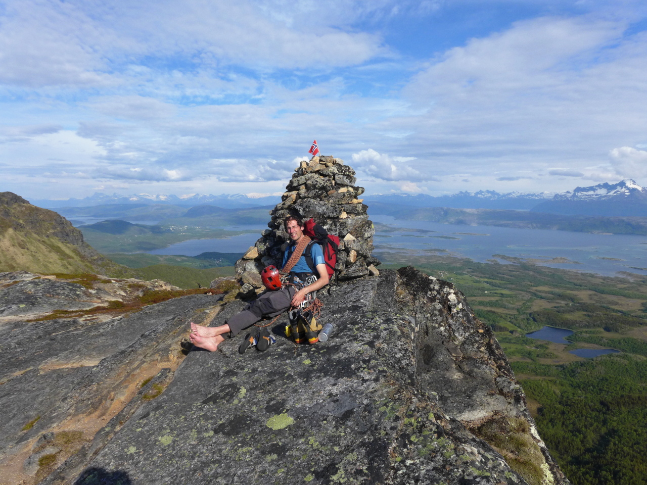 It turned out that the route consisted mostly of walking and fairly easy scrambling with a few pitches of diff & vdiff climbing. The n5- grade comes from a short boulder problem just below the summit. Overall it was great fun, and would make an ideal gentle introduction to Norwegian granite.
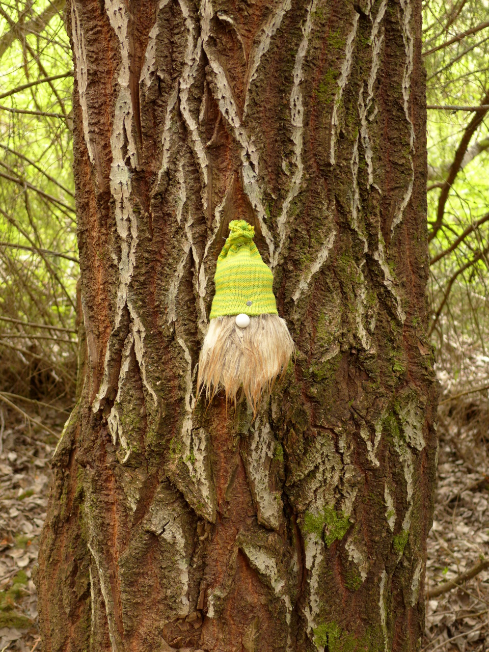
A warning to other gnomes.
At Skutvik we had a couple of hours to kill before the 11pm ferry, and discovered some low level trails leading around a small local hill called Salen. This turned out to be well worth the effort as the views toward Lofoten were spectacular.
Vikings!
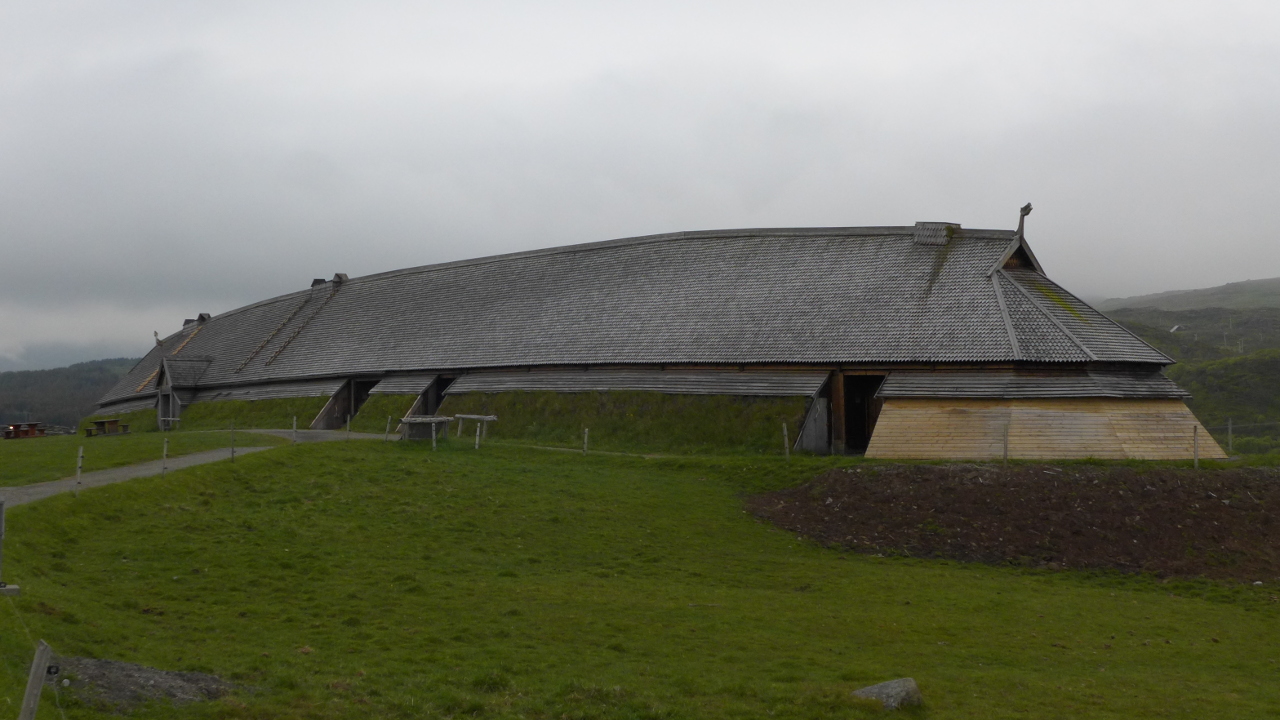 The rain caught up with us the next day and gave us an excuse to pay a visit to the Viking long house at Borg. This is a reproduction of a hall thought to belong to a local chieftain who emigrated to Iceland after falling out with the king in the 10th century. The king in question was Eirik Bloodaxe so this was probably a good idea. The site contains a history exhibition and museum, the long house and various walking trails to other archaeological sites.
Later on the weather cleared up just long enough for some cragging at “Paradiset”, which is a little reminiscent of Sennen. We managed a couple of routes before I managed to fall off and take a chunk out of one of my fingers. It made climbing a bit uncomfortable and the rock got quite slippery with all the extra ketchup on it so it was time to call it a day.
The weather turned bad again the next morning so we did a bit of walking and hit the road for Tromsø.
Svolvaers finest
On our final day in Tromsø we paid a visit to the magnificently politically incorrect polar museum, which tells the stories of the Brave Norwegian Men who sailed north and suffered harsh conditions in order to find furry creatures and kill them. The ground floor is all about clubbing seals, while the second floor contains a large area devoted to a local hunter who specialised in making polar bear traps from wood, string and old machine guns. When this got too boring he would sometimes ride the bears instead.
In between the two is also an exhibition devoted to the polar explorer Roald Amundsen. A large part of this is taken up with artefacts from various expeditions, but there are also large numbers of personal letters, photographs etc. There is also an area devoted to his disappearance and the search for his missing aircraft.
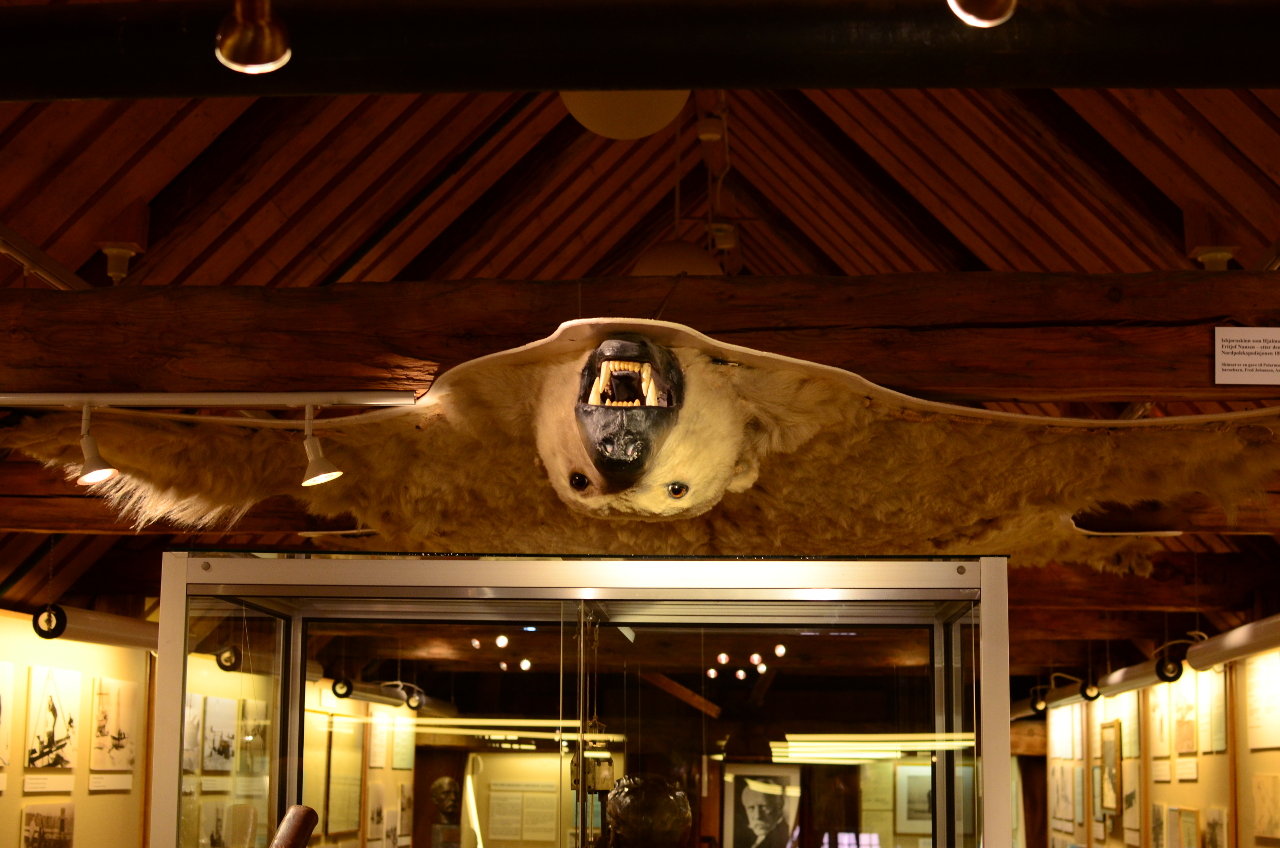
Ceiling Bear is watching you
Øl
The final activity of the holiday has become a bit of a tradition of mine – the “Fokus Kino” bar in Tromsø. This is a pub/cafe attached to a small art house cinema. It sells excellent but ruinously expensive beer and over the years I have found that it is a very effective way of disposing of excess krone, but only at the end of a holiday!
After our second drink I was informed by a slightly horrified J.P. that we were spending approximately 17 times more for beer than we would at his preferred haunt in Tajikistan. I saw things differently. Stowford Press for a tenner and local beer for £8.50 a pint means that Norway is finally going cheap!
John’s Pictures here: https://www.facebook.com/john.proctor.35/media_set?set=a.10101729231144335.1073741843.61401182&type=1&l=fbebf40dc6